If you’ve ever had a fence, driveway, or flood insurance claim turn into a neighborhood argument, you know how fast things can escalate. That’s where an elevation survey becomes more than a technical report—it’s your best legal protection.
In St. Louis, homeowners and builders often order elevation surveys for flood insurance, new additions, or site grading. What many don’t realize is that these surveys sometimes require a surveyor to step a few feet into a neighbor’s yard or near a shared drainage ditch. Recently, a viral Reddit thread showed just how easily that can spark frustration and even legal threats.
Surveyors shared stories about homeowners yelling at them for “trespassing.” Others complained about property damage or dogs chasing field crews off the lot. The truth is, most of these situations come down to one thing—misunderstanding. And in Missouri, the law is clear: surveyors have a right to enter private property to do their job, but they must also document their work carefully to protect everyone involved.
The Real Reason Elevation Surveys Cause Tension
Imagine you’re having an elevation survey done for your home near Creve Coeur Creek or the River Des Peres basin. Your surveyor needs to measure the slope of the land and record the lowest floor elevation to complete your FEMA certificate. To do this accurately, they may need to take readings beyond your fence line—especially if your drainage runs toward a neighbor’s yard or into a public easement.
That’s when problems start. A neighbor sees someone with a tripod or a drone near their fence and thinks, “Hey, why are they on my property?” Within minutes, what should’ve been a simple flood check turns into a shouting match.
This is exactly what that Reddit thread captured—property owners feeling violated and surveyors just trying to do their job. It’s not about bad intentions; it’s about boundaries, both physical and legal.
What Missouri Law Actually Says
Under RSMo §327.371, licensed surveyors have the right to enter private property as long as it’s necessary for a legitimate survey. That means they’re not trespassing when they cross a fence or measure a corner marker—especially if the survey is for flood certification, construction, or property improvement.
However, the same law makes surveyors responsible for any damage they cause. If they break a fence board or crush landscaping, they’re expected to make it right. This balance protects both sides: the homeowner gets the data they need, and the property owner keeps their rights respected.
But here’s the catch—if there’s no clear record of what the surveyor did, it becomes a “he said, she said” argument. That’s why documentation matters.
Why Documentation Matters More Than Ever
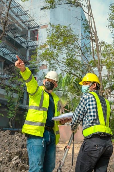
Every elevation survey should come with a clear paper trail. That includes photographs, GPS logs, and field notes showing exactly where shots were taken. These records don’t just make the survey more accurate—they protect you.
For homeowners, a well-documented survey can:
- Prove compliance with flood insurance requirements.
- Show evidence of correct elevations if FEMA or a lender questions results.
- Settle disputes with neighbors if boundaries or grades are challenged later.
For surveyors, detailed documentation means:
- Proof of access rights under state law.
- Defense against false claims of damage or trespass.
- Quality control for future projects in the same area.
Think of it like insurance for your survey. It’s easier to explain what happens when you have timestamps, drone images, and signed reports to back it up.
How Surveyors Keep It Professional
Good surveyors know that communication can prevent conflict before it begins. In St. Louis, many firms follow professional courtesy steps like:
- Leaving door hangers or notices 24–48 hours before visiting fenced properties.
- Wearing visible ID badges or high-visibility vests with company logos.
- Using drones or GPS rovers instead of climbing fences when possible.
- Documenting their entry and exit points with short videos or photos.
A respectful script also helps. For example:
“Hi, I’m with [Company Name]. We’re doing an elevation survey for your neighbor’s flood insurance. We’ll be near your fence for about 30 minutes. Here’s my card if you have any concerns.”
That kind of approach not only builds trust—it keeps the peace.
When Surveyors Should Walk Away
Of course, not every situation is safe or friendly. If a homeowner refuses access, locks the gate, or becomes aggressive, a professional surveyor won’t force entry. Instead, they’ll pause the work and note the obstruction in their report.
Sometimes the next step is contacting local authorities or asking the client to secure written permission. In St. Louis, if the blocked area involves public drainage or flood easements, the Metropolitan St. Louis Sewer District (MSD) can confirm access rights or provide official maps showing easements.
Documenting these steps—who was notified, when they were contacted, and what response was received—can prevent bigger headaches later.
What Homeowners Can Do to Avoid Trouble
If you’re ordering an elevation survey, you can make things smoother for everyone. Here’s how:
- Inform your neighbors ahead of time, especially if surveyors might work near shared fences or driveways.
- Keep gates unlocked on the scheduled day so crews can move safely.
- Ask for a copy of your surveyor’s license and insurance for reassurance.
- Keep digital copies of your FEMA elevation certificate and the supporting survey photos—these documents might save you during future insurance renewals or property sales.
A little communication goes a long way. Your neighbors are far less likely to complain when they know what’s happening and why.
The Bottom Line
An elevation survey isn’t just a technical step for flood insurance—it’s a legal safeguard for your property. In Missouri, surveyors have the right to access land for legitimate work, but the responsibility to document every move lies on both sides.
For homeowners, that documentation proves your elevations are correct and your project is compliant. For surveyors, it’s proof that they acted professionally and lawfully.
So, before you build that new fence or apply for a flood certificate, make sure your surveyor does one thing right—document everything. It could be the difference between a simple inspection and a costly lawsuit.
