
When you order an ALTA Land Title Survey, you expect clear results that lenders, attorneys, and title companies can trust. Yet many surveys take longer than they should. The delays often come from missing local data—like sewer easements, parcel boundaries, or recording requirements. The good news? With the right prep, you can cut out weeks of back-and-forth and keep your closing on track.
Why Preparation Matters
An ALTA Land Title Survey isn’t just a map of boundaries. It’s a deep look at a property, connecting legal descriptions with what exists on the ground. Buyers and lenders rely on it to spot risks. But if important local data is left out at the start, surveyors often have to redo work, reformat plats, or recheck easements. That wastes time and money.
In St. Louis, this problem is avoidable. The city and county offer digital tools that reveal stormwater lines, parcel histories, and recording rules before survey crews ever set up their equipment. Taking advantage of these resources leads to faster surveys, smoother loan closings, and fewer surprises for everyone involved.
Step One: Start with MSD Development Review
The MSD oversees stormwater and sewer infrastructure across the metro area. Their Development Review map app is one of the best starting points for any commercial site. Within minutes, you can see where major storms and sanitary lines run. You can also check if your site overlaps with an active MSD project, which could create conflicts later.
Knowing this information up front allows surveyors to mark potential easements correctly on the ALTA survey. It also sets realistic expectations with buyers and lenders about what restrictions may exist. For properties in flood-prone areas, MSD’s watershed maps can be especially valuable. They highlight drainage paths and low spots that may trigger questions during due diligence.
Step Two: Verify City Parcels
If your property sits within St. Louis City limits, the GeoStLouis portal is a must-use resource. This online system provides parcel identification numbers, block numbers, and links to historic plats. It also displays zoning and land use layers that can impact how a property is described in legal documents.
Surveyors often export this parcel data into CAD software to build an accurate base map before heading to the field. That way, when the ALTA survey is drawn, it already aligns with the city’s official records. For lenders, this consistency is reassuring. For buyers, it means the survey reflects both the property’s physical layout and its legal footprint.
Step Three: Check County Parcels and Adjacencies
For sites, the Property Lookup tool and the Open Data Portal (ODP) are essential. These tools confirm parcel ownership, PINs, and jurisdictional boundaries. They also show overlaps with school districts, fire districts, or other authorities that sometimes appear in title commitments.
Why does this matter? Imagine closing on a commercial site, only to find out later that a small slice of land falls under a different district with separate tax obligations. These kinds of surprises can delay financing. By pulling County parcel data early, surveyors help attorneys and lenders avoid costly mistakes.
Step Four: Don’t Overlook Recorder Requirements
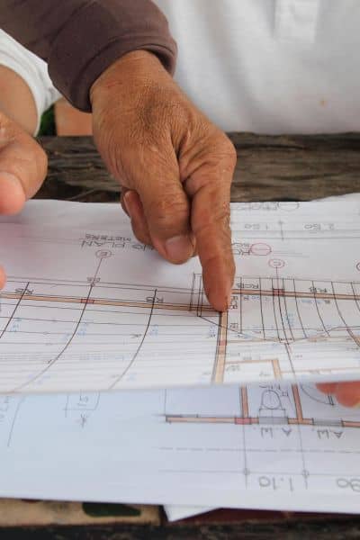
Even the most accurate survey can run into trouble if it doesn’t meet local recorder rules. In St. Louis County, plats and survey documents often need to be submitted on Mylar sheets, with specific margins and title block formats. There’s also a strict 60-day window to record documents after County Council approval.
If you miss these details, you risk rejection and another round of corrections. Thankfully, the County publishes clear standards, and several eRecording vendors are available to make the process faster. Including these requirements in survey prep saves time later and gives clients confidence that their documents won’t hit unnecessary roadblocks.
Step Five: Know When to Request Sewer Base Maps
Beyond the Development Review portal, MSD also maintains detailed sewer base maps. Not all of these maps are available to the public, and some requests require special review. However, when accessible, they provide an excellent way to double-check easement widths and alignments.
For developers, this information can be critical. A hidden storm line can limit where a new building or driveway can go. Having that information on the ALTA Land Title Survey helps the buyer understand risks before money changes hands. For lenders, it confirms that nothing unexpected will threaten the collateral’s value.
Bringing It All Together
Pulling data from MSD, GeoStLouis, and St. Louis County creates what we like to call a Pre-Survey Data Pack. This packet contains sewer alignments, parcel details, recorder specs, and any other records that could affect the ALTA survey.
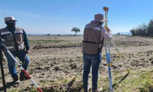
When a licensed land surveyor starts with a complete data pack, the fieldwork and drafting move faster. The surveyor can focus on verifying and mapping rather than scrambling to track down missing information. In the end, clients get a survey that’s cleaner, more reliable, and delivered on schedule.
Conclusion
An ALTA Land Title Survey is only as strong as the preparation behind it. By tapping into MSD maps, GeoStLouis, and County lookup tools, surveyors reduce rework and keep property transactions moving smoothly. Buyers, sellers, and lenders all benefit when surveys are done right the first time.
So the next time you hear that an ALTA survey is taking longer than expected, ask this simple question: Was the local data pulled before field crews started? If not, you’ve found the reason for the delay.
Whether you’re a buyer, lender, or developer, the key takeaway is simple: surveys go faster when local data is pulled early. The right prep makes the process easier, protects your investment, and helps you move forward with clarity.