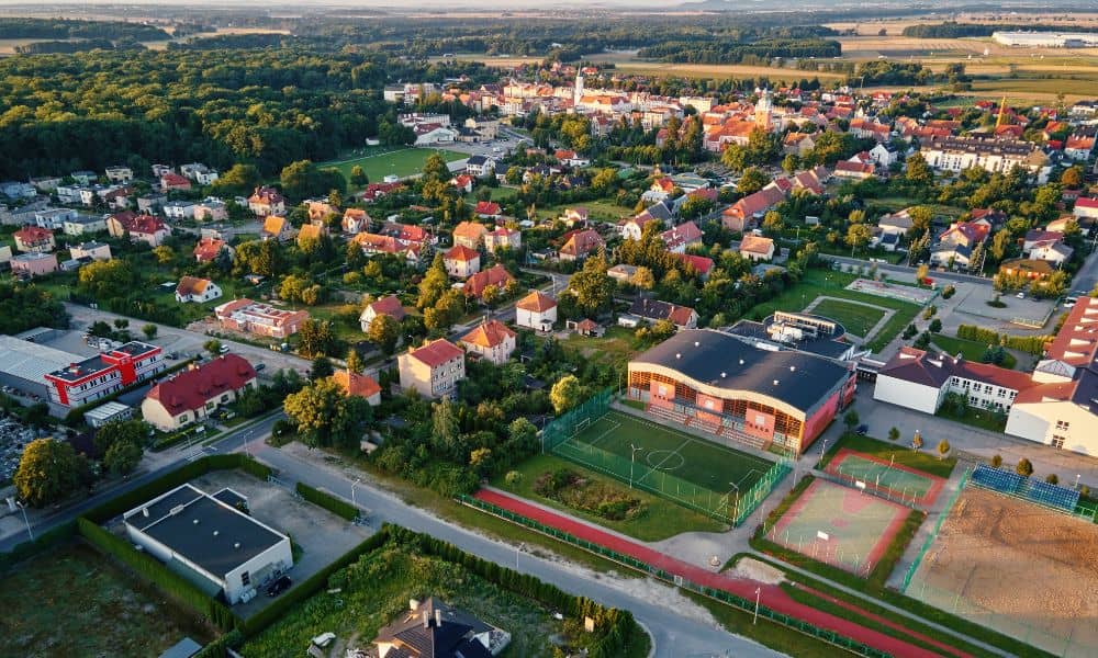
Subdivision planning is moving fast. New neighborhoods are popping up across the metro area as families look for homes near good schools, growing job centers, and modern amenities. With land in high demand, developers can’t afford delays in planning and approvals. That’s why many surveyors and engineers now turn to drones. These powerful tools are transforming how subdivisions are mapped, designed, and built, saving both time and money while improving accuracy.
The Role of Drones in Modern Land Development
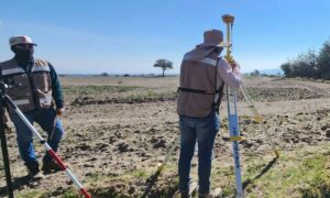
Drones are no longer just for hobbyists or photographers. In Kansas City, surveyors use them daily to scan large tracts of land that would take weeks to measure by foot. Traditional ground crews must walk every corner with equipment, often battling uneven terrain or thick brush. By contrast, drones fly overhead and capture detailed images in minutes.
For developers, this means fewer delays before breaking ground. Instead of waiting on long survey reports, planners can get an accurate view of a property in record time. This is especially valuable in fast-growing neighborhoods like Liberty, Lee’s Summit, or North Kansas City, where demand pushes builders to move quickly.
Faster Data Collection for Subdivision Layouts
One of the biggest advantages of drones is speed. A drone can cover 100 acres in less than an hour, creating precise aerial maps that reveal every feature of the land. Compare that to a crew on the ground, which may take several days to finish the same job.
In subdivision planning, timing is everything. Developers need quick answers about where roads, utilities, and homes can go. When drones provide the data in hours instead of weeks, projects stay on schedule. That means less waiting for permits and more homes delivered to families sooner.
Improving Accuracy with Drone Surveys

Speed is important, but accuracy is just as critical. A single mistake in a boundary line or elevation reading can cause expensive rework. That’s where drone surveying makes a difference. By flying over a site and capturing thousands of data points from multiple angles, surveyors get a clear, high-resolution map of the entire property.
For example, when planning subdivisions in hilly areas like Parkville or Gladstone, drone surveying highlights exact slopes and drainage paths that ground crews might miss. This level of precision helps engineers design roads that handle storm water properly and lots that won’t flood. With fewer surprises during construction, projects move forward faster and with fewer setbacks.
Streamlining Design and Infrastructure Planning
Subdivision layouts involve more than just carving up land into lots. Roads, sidewalks, water lines, power, and storm drains must all fit together. Drones help by supplying detailed topographic maps that planners feed directly into software like GIS or CAD.
This integration gives engineers the ability to model subdivisions before a single shovel hits the dirt. They can test road alignments, check utility routes, and adjust drainage systems—all from their desks. By spotting challenges early, drones prevent costly field changes later.
Drones Reduce Costs and Project Delays
Every developer wants to save money without cutting corners. Drones make that possible. Fewer workers are needed on site because the drone does most of the heavy lifting. Crews no longer spend weeks walking fields, which lowers labor costs.
But the real savings come from avoiding mistakes. When a drone survey highlights an obstacle—like a hidden ravine or an unexpected slope—developers can adjust their plans before construction starts. Fixing these issues ahead of time prevents delays, which is critical in a competitive housing market.
Supporting Fast-Growing Neighborhoods
Kansas City’s suburbs are booming. Areas like Blue Springs, Olathe, and Overland Park continue to attract new residents, and developers must keep pace. Speed is not just a bonus—it’s a necessity. Drones give planners the edge they need to meet demand.
Imagine a developer trying to launch a new subdivision in Raymore. Traditional surveys might push the timeline back months. By using drones, that same developer can present accurate layouts to city officials much faster, gaining approval and starting construction while the market is still hot.
Why Developers Should Embrace Drones Today
Subdivision planning demands tools that are fast, accurate, and reliable. Drones deliver all three. They speed up surveys, reduce errors, and provide the detailed maps engineers need for smart design. With housing demand growing, developers who adopt drone technology can move projects from planning to completion without unnecessary setbacks.
Subdivision projects move quickly and every detail matters. Choosing a surveyor who uses drones ensures your plans stay accurate and your timeline stays on track.