If you are trying to figure out the average cost for a land survey, you are probably feeling confused already. One website says a few hundred dollars. Another says several thousand. That big gap makes people nervous, especially when they are already buying a home, applying for permits, or planning construction.
In St. Louis City, this confusion is common. Land survey costs here depend less on averages and more on why the survey is needed. Once that becomes clear, the pricing starts to make more sense.
Why “Average Cost” Does Not Tell the Full Story
Many people think land surveys are priced only by lot size. Size does matter, but it is not the main reason prices change. The real driver is purpose. A survey for a mortgage closing is very different from one used for construction or a property dispute.
St. Louis City adds another challenge. Many properties are old. Lots of lines are close together. Records can go back many decades. Because of this, surveyors often spend a lot of time reviewing old plats and deeds before visiting the site. That research time affects the final cost, even for small properties.
Boundary Surveys and Why Homeowners Need Them
A boundary survey becomes important when property lines are unclear. Homeowners often request one before building a fence, settling a dispute with a neighbor, or confirming boundaries before selling.
In St. Louis City, boundary surveys can take more work than expected. Corner markers may be missing. Old records may not match what exists today. When that happens, surveyors must dig deeper into historical documents to confirm the true boundaries.
Because of this, boundary surveys usually cost more than basic surveys. Still, many homeowners see the value. A clear boundary helps avoid disputes and protects property value for years to come.
Mortgage Surveys and Property Surveys During Home Sales
During a home purchase, lenders usually require a mortgage survey. This survey checks where buildings sit on the lot and looks for obvious issues. Since it does not fully confirm property lines, the cost stays lower.
That lower price often sounds appealing. However, many buyers do not realize what the survey does not cover. Fence problems, encroachments, and unclear boundaries can still show up later. When that happens, homeowners often order a boundary survey anyway.
Knowing this difference early helps buyers decide whether saving money now is worth the risk later.
ALTA Surveys for Commercial Properties
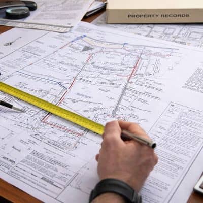
Commercial properties follow a different path. An ALTA land survey supports lenders, title companies, and investors. It shows boundaries, buildings, easements, access points, and other key details needed for due diligence.
In St. Louis City, ALTA surveys are common for redevelopment projects and larger property purchases. These surveys follow strict standards and require close coordination with title work. Because of that, they take more time and cost more.
While the price is higher, these surveys help identify risks early. For investors, that clarity can prevent costly problems after closing.
Construction and Topographic Surveys for Building Projects
Construction projects need more than one type of survey. A construction survey helps contractors place buildings, utilities, and other features in the correct location. This guidance keeps projects on track and avoids mistakes.
Topographic surveys often support construction planning. They show elevation changes, slopes, and surface features. In St. Louis City, this information matters for drainage, grading, and permit approval.
Because these surveys involve detailed measurements and sometimes multiple site visits, pricing depends on the project, not just the lot size.
Why Older Properties Cost More to Survey
Many homeowners feel surprised when survey quotes come back higher than expected. Often, the age of the property is the reason. Older plats, shared alleys, and unclear records make surveys more complex.
Surveyors may need to compare documents created many years apart. They also need to confirm how past changes affect today’s boundaries. This work happens behind the scenes, but it is critical for accuracy.
As a result, older properties often cost more to survey than newer developments, even when the lots are similar in size.
Unexpected Costs That Catch People Off Guard
Survey costs can increase when extra work becomes necessary. Rush requests, missing property corners, or additional city review comments all add time. These issues are common in urban areas and do not mean something went wrong.
Clear communication at the start helps reduce surprises. When surveyors understand the goal early, they can give more accurate estimates.
Understanding the Average Cost for a Land Survey
The average cost for a land survey cannot be reduced to one number. Each survey type serves a different purpose, and each purpose comes with its own level of work.
Once people understand that connection, pricing feels less random. Choosing the right survey early helps avoid delays, disputes, and added costs later. In the end, the value of a land survey comes from the clarity and protection it provides, not just the price on the invoice.