
Buying property often starts the same way. You open a parcel map, zoom in, and study the lines. Everything looks neat. The lot shape makes sense. Nothing seems off. So it feels like you already understand the property. Then something changes. A lender asks for more details. A builder wants confirmation. A title team brings up questions you did not expect. That simple map suddenly feels less reliable. That is usually when buyers start reaching out to reliable surveying companies to double-check that everything matches up before moving forward.
What Those Parcel Maps Are Really Showing
Parcel maps give a quick snapshot of a property. You can see where it sits and how it lines up with nearby lots, which helps a lot during early research.
But they are not meant to confirm exact measurements. They are built for records and reference, so they only give a general idea, not a final answer.
The lines you see come from stored data, not from someone checking the property in person. That means the map reflects what is written down, not what has been measured on the ground.
That difference is easy to miss until you look into it a bit more or speak with professional land surveyors who can explain how those lines match up in real life.
Why the Lines Feel More Accurate Than They Are
When you zoom in, the lines look sharp. Straight edges, clean corners, and clear boundaries create a sense of precision.
It feels exact.
But that feeling comes from how the map is drawn, not from how the land was measured. The screen makes everything look settled, even when small differences exist in real life.
Those small differences matter once you start making decisions.
Where Buyers Start to Run Into Trouble
At first, nothing seems wrong. The map gives enough confidence to move forward. Buyers begin planning without thinking twice about the accuracy of those lines.
Then reality starts to catch up.
A contractor may need exact placement before starting work. A lender may want confirmation before approving the deal. A title company may ask for verification before closing.
Now the buyer has to pause and rethink what they assumed.
The map did its job for research, but it did not answer the questions that matter later.
Where Surveying Companies Step In
This is where surveying companies come into the picture.
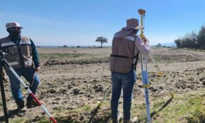
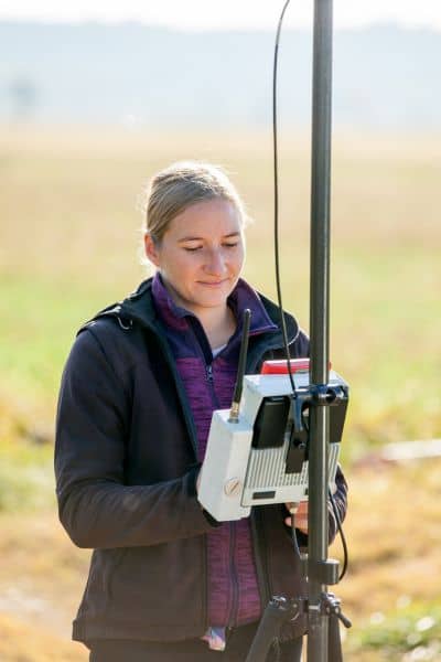
They do not rely on what appears on a screen. They go out to the property and measure it directly. They check how the recorded lines match the actual land.
They look for markers, verify positions, and confirm how everything lines up.
That process turns a rough outline into something solid.
Instead of guessing, buyers get clear information they can trust.
A Situation That Happens More Often Than You Think
A buyer finds a property and studies the parcel map. The shape looks perfect for what they want. There seems to be enough space for a home, a driveway, and maybe a small addition later.
Plans begin right away.
Then a builder asks for a verified layout. The buyer shows the map. The builder asks for a survey instead.
That moment changes everything.
Once the property gets measured, the usable space turns out to be slightly different than expected. Nothing dramatic, but enough to adjust the plan.
That small shift could have caused bigger issues if it stayed unnoticed.
Why Others Still Ask for a Survey
Even when buyers feel confident, other people involved in the process often want confirmation.
Lenders need to reduce risk. Title teams need to make sure records match the property. Builders need accurate measurements before they start.
They are not relying on the map alone.
They want to know that what is on paper matches what is on the ground.
That is why they still point buyers toward surveying companies.
When a Parcel Map Is Enough
Parcel maps still have their place. They help you get familiar with a property. They make it easier to compare locations and understand general layout.
For early stages, they save time and give helpful context.
There is nothing wrong with using them that way.
When You Need More Than a Map
There comes a point when a general view is no longer enough.
That point shows up when you are ready to move forward. When decisions carry more weight, rough estimates stop being useful.
You need to know where things actually sit, not where they seem to sit.
That is when buyers decide to contact surveying companies.
Why This Matters More in Jackson County
Jackson County continues to grow, and more people are looking at land and property in the area. At the same time, many records have been around for years.
That mix creates small gaps between what is recorded and what exists today.
Online tools make it easy to view property details. They also make it easy to trust those details too quickly.
Buyers who take the extra step early avoid running into problems later.
A Map Shows the Idea. A Survey Confirms the Property
A parcel map helps you get started. It shows you the shape and location of a property.
But it does not confirm the details you need to move forward with confidence.
Buyers who want clarity still turn to surveying companies before making final decisions. They want to be sure the property matches what they see before they commit.
That extra step may feel small at first. In many cases, it is what keeps everything on track.