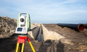
Kansas City is buzzing again. A new poll shows rising support for moving the Royals to a new suburban stadium, and the debate is heating up fast. People are talking about traffic, parking, money, and tradition. But behind all the noise, one quiet factor could guide the entire decision: the topo survey.
A topo survey appears in the early stages of every major development, and it does more than many fans realize. It might even help decide where the Royals play for the next 30 years. As the city weighs its options, this early survey will reveal which potential site works—and which one falls apart once the land is studied up close.
Why a Stadium’s Future Begins With the Ground Under It
Whenever a big project like a stadium starts, the first step isn’t design or financing. It’s learning how the land behaves. A topo survey maps the natural shape of the ground, showing slopes, high points, low points, and other terrain features. This might sound simple, but in a project this large, these tiny details can swing decisions worth millions of dollars.
Think about it this way: a stadium isn’t a small building. It’s a huge structure sitting on a very large footprint. Parking lots, walkways, fire lanes, loading docks, and emergency exits all need safe and stable ground. A topo survey tells engineers whether a site can support these pieces without massive, expensive changes.
Kansas City’s landscape makes this work even more important. Some suburbs sit on rolling hills. Others lie on heavy clay soil. Some areas near the Missouri River hold water after big storms. Without a topo survey, planners would be guessing—and guessing leads to delays, redesigns, and blown budgets.
How a Topo Survey Shapes a Stadium Site

Once a team of surveyors gathers topo data, developers can see the land’s strengths and weaknesses. That’s when the real decision-making begins. Even small changes in the land can shape everything about a stadium’s final plan.
Slope and grading matter more than most people think. A stadium needs stable, mostly level ground. If the land drops too quickly, engineers must cut into hills or build up low spots. Both choices cost money. Sometimes a lot of money. A topo survey helps reveal whether a chosen site needs light cleanup—or huge grading work that risks blowing the project budget.
Parking also becomes a major challenge. Stadium parking lots stretch over acres of pavement. If the land isn’t fairly smooth, fans might deal with unsafe slopes or drainage issues. A topo survey shows whether the land can support safe parking without expensive fixes.
Stormwater is another big factor. A stadium roof and parking area create massive amounts of runoff. Without good drainage, these areas flood fast. Kansas City deals with heavy storms, so this part matters. A topo survey shows where water naturally flows and helps engineers design safe paths for runoff before problems appear.
Even building orientation depends on the topo survey. The ground affects sun exposure, wind patterns, and sightlines. Architects use topo maps to position the seating bowl so fans enjoy the best experience.
This is why the survey isn’t just a technical formality. It’s a major piece of the process.
The KC Metro Has Unique Terrain Challenges
Developers looking at potential stadium sites in the Kansas City metro already know the area isn’t flat or simple. Certain terrain features could make or break entire locations.
Parts of the metro sit on hard limestone. That’s great for stability, but tough for excavation. Digging too deep becomes expensive fast. A topo survey helps planners avoid surprises early.
Other areas face flood concerns. Lowlands near the Missouri River and creek systems collect water during storms. Even a small dip in elevation can turn into a drainage headache when 30,000 fans show up. A topo survey highlights these risks so planners can rule out unsafe sites.
The rolling suburban hills also add challenges. Some areas offer open land, but the terrain may roll in ways that demand huge cut-and-fill work. These costs stack up fast and can push developers toward different locations.
Even though the public debate focuses on location and cost, surveyors quietly collect the data that shows whether each proposed site is physically buildable.
How Topo Data Influences Infrastructure Planning
A topo survey shapes everything around the stadium, not just the stadium itself.
Roads and access points depend on elevation. Thousands of fans will arrive within a short time window, so engineers have to design safe turn lanes, exits, and entry points. Elevation changes influence every one of these elements.
Pedestrian and traffic flow also rely on topo data. Walkways must avoid steep grades. Rideshare zones, sidewalks, ADA access routes, and transit stops all depend on stable ground.
Emergency routes matter too. Fire trucks, ambulances, and police vehicles require clear access with specific turning needs. If slopes are too steep, emergency routes won’t pass safety reviews.
Utility design is another hidden challenge. Stadiums need strong power lines, water supplies, sewer systems, and telecom connections. The path of these utilities often depends on the land profile revealed by a topo survey.
With so many moving parts, the topo survey becomes a quiet but powerful guide behind every design decision.
Why This Matters to Developers and Land Buyers
You don’t need to build a stadium for any of this to matter. The Royals debate shows how important topo work is for any project. Developers, commercial buyers, and even investors can learn from this moment.
A topo survey reduces risk, reveals hidden costs, and shows whether a piece of land is worth the investment. And because every site behaves differently, having a professional land surveyor involved early helps you understand the land in a way a simple map never could. If topo data can influence a project as big as a stadium, it can definitely shape smaller commercial builds like warehouses, entertainment centers, retail buildings, or mixed-use spaces.
Early topo data helps prevent expensive regrading, avoid drainage failures, speed up design, and keep projects on budget. The Royals stadium debate proves that land accuracy is not just a technical detail—it’s a roadmap for the entire project.
Surveyors Should Prepare for Higher Demand
With stadium talk building momentum, surveyors in the KC metro may see more requests for large-parcel topo surveys. Developers want to move fast, and they rely on accurate mapping early in the process. Drone mapping, LiDAR scanning, and detailed deliverables are becoming more common as teams try to understand their land options quickly.
Surveyors may also join early feasibility studies, where topo data guides buying decisions before any announcements reach the public. When big projects heat up, everything moves quickly, and survey teams become key players behind the scenes.
Conclusion:
Whether the stadium moves or stays put, this debate highlights one simple truth: the most important decisions start with the land. A topo survey gives developers the clear picture they need before committing millions of dollars. It guides the design, the cost, the fan experience, and even the long-term success of the project.
Kansas City is watching the stadium debate closely, but the ground under each potential site may end up making the biggest call of all.


