Buying a home in parts of Kansas means you may encounter a flood elevation certificate (EC) at some point. Instead of staring blankly at its numbers, here’s how to read and use it wisely—without repeating technical definitions.
Why Homebuyers Should Pay Attention
This form influences:
✅ Insurance rates: Lenders and insurers compare your finish-floor height to zoning specifics.
🏠 Cost estimation: Being above FEMA’s flood threshold may lower your premiums.
⏱ Prep for construction: It guides future build decisions on elevation or flood-proofing.
How to Access or Update Yours
Need an EC? Consider:
- Asking the seller or real estate agent if it’s available.
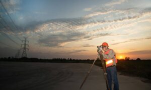
- Ordering one via a Kansas‑licensed surveyor or engineer. If you’re not sure where to begin, talking to a licensed land surveyor near you can help you understand the requirements and get accurate elevation data faster.
- Checking local building offices, which may hold on file.
Surveys usually take 1–2 weeks and cost between $500–$1,200, depending on size and foundation details.
Breaking Down the Certificate Sections
✔ Section A: Property Info
Shows address, structure type (e.g., one-story, slab, crawl) and parcel number.
✔ Section B: FEMA Map & Zone
Identifies flood zone category—like AE or X—and provides relevant map/detail dates.
✔ Section C: Measured Heights
Highlights Lowest Adjacent Grade (LAG) and Finished Floor Elevation (FFE), compared to FEMA’s Base Flood Elevation (BFE).
- If FFE ≥ BFE → lower risk
- If FFE < BFE → risk is higher
✔ Section D: Professional Endorsement
Certified by a licensed surveyor or engineer—confirming proper measurement standards were used.
Key Terms and their Meaning
- Base Flood Elevation (BFE): Threshold for expected floodwaters.
- Finished Floor Elevation (FFE): Height of your home’s main living area.
- Lowest Adjacent Grade (LAG): Ground level near your home’s foundation.
- Flood Zones:
- Zone AE: High-risk, mandatory insurance
- Zone X (shaded/unshaded): Moderate or minimal risk
- Zone AE: High-risk, mandatory insurance
Common Mistakes to Avoid
- Ignoring datum references (NAVD88 vs NGVD29).
- Not recognizing altered homes—additions can change an FFE.
- Overlooking map validity—provide the most recent FEMA map date.
- Misunderstanding abbreviations like FFE, BFE, or LAG.
How It Helps in Real Estate Transactions
🔒 Proof for lenders that insurance is controllable
🛠 Insight into whether grade-raising is needed
💸 Opens door to insurance rate discounts or premium avoidance
Actionable Tips for Buyers
- Always ask for a current copy of the EC before making an offer.
- Compare the FFE with FEMA’s base number—your insurer will.
- If elevation data shows higher risk, negotiate seller assistance or request a separate mitigation survey.
Final Takeaway
Instead of glossing over the flood elevation certificate, use it to gauge flood risk, negotiate costs, and prepare your home accordingly. It’s a powerful tool to help you buy with confidence in areas facing flood exposure
Quick FAQs
Q1: Can I save by using an old certificate?
Maybe—only if nothing has changed. But check with your lender.
Q2: Does it need to be submitted to FEMA?
No—usually handled between your insurance company, lender, and local offices.
Q3: Who pays for it?
Typically the buyer or borrower, but contracts can adjust this.
