Why ALTA Surveys Matter in Property Transactions

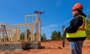
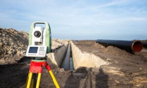
Professional surveyors using a total station to perform an ALTA survey on undeveloped property for a real estate transaction

An ALTA survey is a detailed map of a property that shows its boundaries, buildings, fences, roads, and other important features. It’s created by a professional land surveyor and follows strict standards set by the American Land Title Association (ALTA) and the National Society of Professional Surveyors (NSPS). This survey helps everyone involved in a property transaction understand exactly what is being bought or sold.

Why Are ALTA Surveys Important in Missouri?

In Missouri, properties can have complex histories, including old fences, hidden easements (rights for others to use part of the land), or unclear property lines. An ALTA survey helps uncover these issues, ensuring that buyers know what they’re getting and that sellers can prove they own the property they’re selling. This clarity helps prevent future legal problems or disputes.

Benefits for Buyers and Sellers

  • For Buyers: An ALTA survey shows the exact boundaries of the property and any structures on it. It also reveals any easements or restrictions that might affect how the property can be used.
  • For Sellers: Providing an ALTA survey can make the selling process smoother by addressing potential issues upfront and showing transparency to buyers.

How ALTA Surveys Protect Buyers and Lenders

An ALTA survey is more than just a map—it’s a tool for risk reduction.

🔒 For Buyers:

  • Reveals boundary disputes, access limitations, or encroachments
  • Ensures the land is accurately represented in legal documents
  • Supports due diligence before purchase

💼 For Lenders:

  • Helps verify the legal boundaries of the property
  • Protects against unknown risks that could impact collateral value
  • Ensures accurate documentation for financing decisions

Because lenders base their loans on property value and legality, a detailed ALTA survey reduces uncertainty and protects their investment.

ALTA Surveys and Title Insurance

Title insurance companies often require an ALTA survey—the survey required for title insurance—to issue a comprehensive title policy.This survey allows them to:

  • Confirm the property’s dimensions and legal description
  • Identify any encroachments or easements not found in public records
  • Provide accurate title coverage for buyers and lenders

Without a current ALTA survey, title insurance coverage may be limited, putting both the buyer and lender at risk.

Final Thoughts

An ALTA survey is a valuable tool in any property transaction. It offers clear, detailed information about a property’s boundaries, easements, and potential legal issues—empowering buyers, sellers, and lenders to make informed decisions.

Whether you’re buying, selling, or financing property, it’s essential to order an ALTA survey to ensure a smooth, legally sound transaction and avoid costly surprises down the road.

author avatar
Surveyor

More Posts

Land surveyor using a total station during an elevation survey to record precise land measurements for documentation
flood damage
Surveyor

Why Every Elevation Survey Should Be Documented

If you’ve ever had a fence, driveway, or flood insurance claim turn into a neighborhood argument, you know how fast things can escalate. That’s where an elevation survey becomes more than a technical report—it’s your best legal protection. In St. Louis, homeowners and builders often order elevation surveys for flood

Read More »
Aerial view of construction site showing trucks and heavy equipment preparing land development that requires an alta title survey
alta survey
Surveyor

Why Data Centers Need an ALTA Title Survey First

Kansas City is in the middle of a digital building boom. Just last month, Port KC approved billions in private funding for new data centers, and companies like DataBank have already started expanding their footprint in the metro. These massive projects power the internet, cloud storage, and the apps we

Read More »
Land surveyor using a total station and reviewing records for an ALTA Land Title Survey
alta survey
Surveyor

ALTA Land Title Survey Prep: MSD & County Records

When you order an ALTA Land Title Survey, you expect clear results that lenders, attorneys, and title companies can trust. Yet many surveys take longer than they should. The delays often come from missing local data—like sewer easements, parcel boundaries, or recording requirements. The good news? With the right prep,

Read More »
Aerial view of a neighborhood with houses and cleared lots highlighting property line survey disputes and urban development
boundary surveying
Surveyor

Property Line Survey Sparks Neighborhood Controversy

If you live in Kansas City or own property here, you’ve probably heard about the recent controversy in the Valentine neighborhood. At the heart of this debate is a simple but powerful tool called a property line survey. This survey defines where one property ends and another begins. But in

Read More »
Surveyor performing a boundary survey on residential property after ground movement
boundary surveying
Surveyor

Why Even a Small Quake Calls for a Boundary Survey

On September 5, 2025, a 2.4 magnitude earthquake shook near Fenton in South St. Louis County. Most residents didn’t even notice it. No broken windows, no major cracks, and certainly no chaos. Yet, even a minor event like this can shift things in ways that aren’t obvious. That’s where a

Read More »
Drones capturing an aerial view of subdivision layouts in Kansas City
land surveying
Surveyor

How Drones Speed Up Subdivision Planning Work

Subdivision planning is moving fast. New neighborhoods are popping up across the metro area as families look for homes near good schools, growing job centers, and modern amenities. With land in high demand, developers can’t afford delays in planning and approvals. That’s why many surveyors and engineers now turn to

Read More »