Why ALTA Surveys Matter in Property Transactions

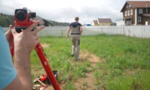
Professional surveyors using a total station to perform an ALTA survey on undeveloped property for a real estate transaction

An ALTA survey is a detailed map of a property that shows its boundaries, buildings, fences, roads, and other important features. It’s created by a professional land surveyor and follows strict standards set by the American Land Title Association (ALTA) and the National Society of Professional Surveyors (NSPS). This survey helps everyone involved in a property transaction understand exactly what is being bought or sold.

Why Are ALTA Surveys Important in Missouri?

In Missouri, properties can have complex histories, including old fences, hidden easements (rights for others to use part of the land), or unclear property lines. An ALTA survey helps uncover these issues, ensuring that buyers know what they’re getting and that sellers can prove they own the property they’re selling. This clarity helps prevent future legal problems or disputes.

Benefits for Buyers and Sellers

  • For Buyers: An ALTA survey shows the exact boundaries of the property and any structures on it. It also reveals any easements or restrictions that might affect how the property can be used.
  • For Sellers: Providing an ALTA survey can make the selling process smoother by addressing potential issues upfront and showing transparency to buyers.

How ALTA Surveys Protect Buyers and Lenders

An ALTA survey is more than just a map—it’s a tool for risk reduction.

🔒 For Buyers:

  • Reveals boundary disputes, access limitations, or encroachments
  • Ensures the land is accurately represented in legal documents
  • Supports due diligence before purchase

💼 For Lenders:

  • Helps verify the legal boundaries of the property
  • Protects against unknown risks that could impact collateral value
  • Ensures accurate documentation for financing decisions

Because lenders base their loans on property value and legality, a detailed ALTA survey reduces uncertainty and protects their investment.

ALTA Surveys and Title Insurance

Title insurance companies often require an ALTA survey—the survey required for title insurance—to issue a comprehensive title policy.This survey allows them to:

  • Confirm the property’s dimensions and legal description
  • Identify any encroachments or easements not found in public records
  • Provide accurate title coverage for buyers and lenders

Without a current ALTA survey, title insurance coverage may be limited, putting both the buyer and lender at risk.

Final Thoughts

An ALTA survey is a valuable tool in any property transaction. It offers clear, detailed information about a property’s boundaries, easements, and potential legal issues—empowering buyers, sellers, and lenders to make informed decisions.

Whether you’re buying, selling, or financing property, it’s essential to order an ALTA survey to ensure a smooth, legally sound transaction and avoid costly surprises down the road.
author avatar
Surveyor

More Posts

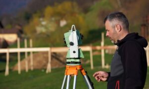
Professional surveyors using a total station to perform an ALTA survey on undeveloped property for a real estate transaction
alta survey
Surveyor

Why ALTA Surveys Matter in Property Transactions

An ALTA survey is a detailed map of a property that shows its boundaries, buildings, fences, roads, and other important features. It’s created by a professional land surveyor and follows strict standards set by the American Land Title Association (ALTA) and the National Society of Professional Surveyors (NSPS). This survey

Read More »
A drone hovers near the Scout statue overlooking downtown Kansas City, symbolizing the use of aerial LiDAR mapping in modern urban development.
land surveying
Surveyor

LiDAR Mapping: Changing How We Build Cities

In Kansas City, development is booming. New roads, buildings, and parks are changing the skyline—and behind many of these changes is a powerful tool called LiDAR mapping. It might sound like something from science fiction, but it’s very real and very useful. Let’s explore how LiDAR is helping Kansas City

Read More »

How to Read a Flood Elevation Certificate: A Homebuyer’s Guide

Buying a home in parts of Kansas means you may encounter a flood elevation certificate (EC) at some point. Instead of staring blankly at its numbers, here’s how to read and use it wisely—without repeating technical definitions. Why Homebuyers Should Pay Attention This form influences: ✅ Insurance rates: Lenders and

Read More »
Land surveyor in Kansas performing fieldwork to support a flood elevation certificate for real estate or insurance compliance.
flood damage
Surveyor

When to Request a Flood Elevation Certificate in Real Estate Deals

If you’re planning to buy, develop, or refinance property in Kansas—especially in low-lying or river-adjacent areas—a flood elevation certificate might be a necessary document. This report isn’t just paperwork; it’s essential for determining flood risk, obtaining accurate flood insurance rates, and complying with FEMA and local building regulations. Understanding when

Read More »

Welcome to ALTA Survey Missouri

Your Final Stop for Your ALTA Survey Needs!                              Contact us today for a free quote! This site is intended to provide you with information on ALTA Surveying in Missouri. If you’re looking for a Missouri Land

Read More »

What Is A Land Surveyor?

A Land Surveyor is essential whenever you plan on building on property, or buying an already built commercial property.  Many land surveyor have worked throughout our country history. In fact, three of the four faces carved on Mount Rushmore are land surveyors (Presidents George Washington, Thomas Jefferson and Abraham Lincoln

Read More »