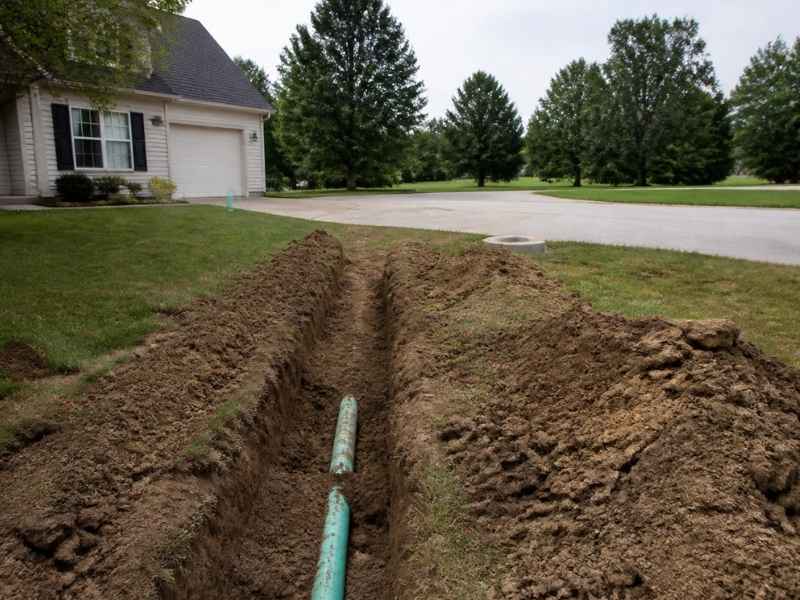
Sewer lines run on gravity, and gravity doesn’t forgive guesswork. If a new line sits too flat, too high, or in the wrong spot, waste backs up, crews dig twice, and inspections stall. Land surveying gives your engineer and contractor real numbers before anyone breaks ground. With accurate locations, elevations, and easement lines in hand, the connection can be designed to drain right the first time.
This guide is written for property owners, builders, and small developers planning a new sewer tie-in. Engineers and contractors will find it useful too, especially when deciding what survey data to ask for. You’ll see what a surveyor maps, why elevation matters so much, and which records to keep once the work is done.
Existing Sewer Lines and Their Position on the Property
The first step is finding out what’s already in the ground. A surveyor locates visible sewer features like manholes, cleanouts, and connection points, then ties them to your property lines. That shows where the public main runs and how far it sits from your building. It also shows whether an old line crosses the spot where you plan to build.
Records help, but they aren’t always right. Older sewer maps may show lines in the wrong place or leave out private laterals entirely. A lateral is the private pipe that runs from a building to the public main. Many older lots have laterals that were never mapped, so field work matters.
What to Gather Before the Survey
Bring what you have to your first talk with the surveyor. Useful items include:
- Your deed and any past survey or plat
- Sewer or utility maps from the local utility
- Old permits, plans, or as-builts for the building
- Notes on where cleanouts or past repairs are located
Ask whether the survey will locate underground lines or only visible features. Buried pipes often need a utility locate, a sewer camera, or utility records. Scope can vary by project, so get it in writing.
How Land Surveying Supports Gravity-Fed Sewer Connections
Most building sewers flow by gravity, so the pipe must slope downhill all the way to the main. Land surveying measures the ground and existing pipe heights so the engineer can check that the slope works. A pipe that’s too flat lets solids settle and clog. If the numbers don’t work at all, the project may need a new route or a pump system.
Local codes and the sewer utility set slope rules, and those rules can vary. Your surveyor won’t design the line, but they give the designer the data needed to meet those rules. That data also heads off expensive surprises. Finding out mid-dig that the main is higher than expected can stop a job cold.
Utility Easements and Available Space for New Sewer Lines
Before picking a route, you need to know where the pipe is allowed to go. A utility easement gives a utility the right to use part of a property for its lines, and some may already cross your lot. A title report lists recorded easements, and the survey shows where they fall on the ground. Together, they show how much room you really have.
Space is often tighter than it looks. Water, gas, power, and storm lines may share the same strip. Many codes require a set distance between sewer and water lines, though the exact rule can vary by location. A survey that maps nearby utilities helps the designer find a route that fits. Accurate survey mapping helps the design team understand how existing site features and drainage infrastructure may affect the proposed utility route.
If the new line must cross a neighbor’s land or a public right-of-way, you may need a new easement or a permit. Talk with the utility and, when needed, an attorney. Start early, since these agreements can take weeks.
Elevation Data Needed for Sewer Connection Design
Elevation data is the most important part of a sewer survey. The key number is the invert, which is the inside bottom of a pipe where the flow runs. The surveyor measures the invert at the manhole or main where you’ll connect. They also record ground heights along the route and key points at the building.
Common Elevation Points to Request
Your engineer may ask for some or all of these:
- Invert elevations at nearby manholes and the planned tie-in point
- Rim elevations at manhole covers
- Finished floor elevation of the building, including any basement
- Ground elevations along the proposed route
Every elevation should tie to a benchmark, which is a fixed point with a known height. That way, the designer, contractor, and inspector all work from the same numbers. Ask which datum the survey uses so it matches the utility’s plans.
Basements need extra care. If a floor sits low compared to the main, the design may need added protection against backups. Your engineer and local code will decide what’s required.
Construction Layout and Final As-Built Sewer Documentation
Once the design is approved, the surveyor can stake the route. Construction layout, often called staking, marks pipe locations, cleanouts, and grade so crews dig to the right depth. Stakes or offsets show how deep the pipe should be at each point. That means less guessing and less rework in the trench.
Before digging, call 811 to have public utilities marked. Private lines may need a separate locator. Don’t assume an old line is abandoned or buried deep enough to miss.
After the pipe goes in, and before the trench is fully closed, an as-built survey records where it actually ended up. It shows the final location, depth, and inverts of the new line. Many utilities and inspectors ask for one, though requirements vary. Keep a copy with your property records, since future buyers, lenders, and contractors will want it.
Frequently Asked Questions
Do I need a survey to connect to a public sewer?
It depends on the project and the local utility. Many simple home hookups only need a permit and an approved plan. Larger projects, new buildings, and tight sites often need survey data for design and approval. Ask the utility and your engineer what they’ll require before you schedule any digging.
Can a surveyor tell me how deep my sewer main is?
A surveyor can find the depth at manholes by measuring rim and invert elevations. Between manholes, depth is usually estimated from those points and utility records. If the exact depth at one spot matters, the line may need to be exposed or checked with other tools. Your surveyor can explain which method fits your site.
What if there isn’t enough slope for a gravity sewer?
The engineer may look at a different route, a deeper tie-in, or another connection point. If none of those work, a pump system may be needed. Pumps add cost and upkeep, so it helps to know early. Good elevation data lets you find this out during design instead of during construction.