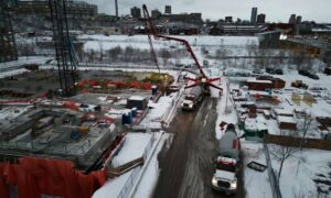
Kansas City is celebrating again. The Main Street Streetcar Extension, which opened on October 24, 2025, now runs all the way from downtown to UMKC. With eight new stops and bright red transit-only lanes, Main Street looks completely different. But behind the smooth new ride stands an unsung professional who made sure every curb and ramp landed in the right spot — the licensed land surveyor.
In big city projects, inches matter. A curb off by two inches can throw off drainage, ADA ramps, and inspection schedules. A licensed land surveyor keeps those mistakes from happening so contractors stay on time and on budget.
The Streetcar’s New Challenges for Builders
The expansion changed more than just traffic flow. It tightened rights-of-way, added ADA-compliant crossings, and packed more utilities under Main Street than ever before.
Contractors working near the red lanes must deal with narrow space, active tracks, and city inspectors who demand exact measurements. Missing a stake or pouring a ramp in the wrong place can stop a job for days. That’s why a licensed land surveyor is one of the first people called before crews break ground.
How a Licensed Land Surveyor Keeps Projects on Track

1. Confirming Right-of-Way Before Digging. Surveyors start by checking plats, deeds, and control points to mark the legal edge of the work zone. Along Main Street, where public and private property meet, this step prevents construction from creeping into city land. Clear boundaries mean no stop-work orders or fines later.
2. Staking Ramps, Curbs, and Platforms. Those bright survey stakes you see near construction aren’t random—they guide crews on elevation, slope, and alignment. A licensed land surveyor sets them with precision so ADA ramps meet slope limits and curbs match design grades. When the city inspector arrives, everything fits exactly as planned.
3. Coordinating with Utility and Trade Crews. Beneath the corridor runs a web of power lines, fiber cables, and storm drains. Surveyors work with utility locators and engineers to map safe zones before anyone digs. They also catch design conflicts early, like a manhole placed too close to a curb return. Fixing it on paper is far cheaper than fixing it in concrete.
4. Delivering Certified As-Built Surveys. When the job’s done, the city needs proof that the finished work matches the approved plans. Only a licensed land surveyor can issue that certification. Their as-built survey records the final elevations and locations, allowing contractors to close out the project and get paid without delay.
Why Licensing Matters
Anyone can use a GPS, but only a licensed land surveyor can legally certify boundaries and elevations. Licensing means they’ve met strict education, testing, and ethics standards. Their seal carries legal weight and protects both builders and the city from costly disputes.
They also understand local codes, ADA requirements, and Kansas City’s approval process — knowledge that keeps complex projects like the streetcar expansion fully compliant.
Growth Beyond the Tracks
Since the streetcar opened, new development has followed. Builders near Midtown and UMKC are planning apartments, parking decks, and retail spaces. Every one of those projects starts with accurate surveying.
Surveyors help developers:
- Map existing elevations for drainage and grading.
- Confirm property boundaries before fencing or paving.
- Provide construction staking for new structures.
Early involvement keeps designs realistic and prevents expensive redesigns once construction begins.
The Cost of Skipping the Survey
Skipping a survey often leads to bigger problems later. One contractor along Main Street poured a curb that extended into the red lane. It passed unnoticed—until inspection day. The fix? Tear out the section and repour it. Two lost weeks, thousands of dollars gone.
A licensed land surveyor would have caught that with a single boundary check. It’s a simple reminder: surveying is far cheaper than rebuilding.
Choosing the Right Survey Partner in Kansas City
If your site touches public right-of-way or sits near the streetcar line, look for a surveyor who:
- Holds a license in land surveying.
- Knows city and ADA codes.
- Uses modern tools like drones and laser scanners.
- Communicates clearly with inspectors and other trades.
The right professional keeps your schedule steady and your paperwork clean.
Conclusion — Precision Keeps Kansas City Moving
Kansas City’s new streetcar isn’t just a transportation upgrade—it’s proof of what precision can build. Every ramp, platform, and crosswalk owes its accuracy to a licensed land surveyor who turned drawings into reality.
Whether you’re managing a large public project or a private build, hiring a licensed surveyor is the smartest way to stay compliant, save time, and avoid costly rework.
When progress moves this fast, precision keeps it on track.
