
When you start a subdivision project, one thing comes before all others: the topographic survey. This survey maps out the land in detail, showing both natural and man-made features. Developers, engineers, and even city officials rely on it because it forms the blueprint for everything that comes next. Without this first step, subdivision planning is like trying to design a house without knowing the size or shape of the lot.
What Is a Topographic Survey?
A topographic survey is a map of the land that shows contours, elevations, and details above and below the surface. In simple terms, it tells you how the land rises and falls. It also records where trees, roads, utilities, and drainage systems are located. Many people call it a contour survey because the contour lines are the most visible part, but that is only one piece. A topographic survey goes further by combining contour data with details about utilities, vegetation, and other site features.
In Kansas City, where terrain shifts between flat lots and rolling hills, these details are not just helpful—they are necessary. Builders need to know how steep a slope is before deciding where to place homes, roads, and stormwater systems.
What Data Is Collected in a Topographic Survey?
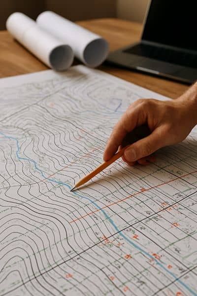
A proper survey includes more than just elevation lines. The data collected paints a full picture of the site. Some of the main items are:
- Contours and elevations – show slopes, ridges, and low spots that affect grading.
- Drainage patterns – indicate how water flows across the property, which is vital in Kansas City’s storm-heavy seasons.
- Vegetation and trees – large trees and wooded areas may impact layout and require permits for removal.
- Utilities and easements – existing sewer lines, water mains, and right-of-ways guide where new infrastructure can be placed.
- Structures and nearby features – fences, driveways, or neighboring buildings can shape design decisions.
This data is what engineers and planners use to design a subdivision that works in real life, not just on paper.
Why Subdivision Planning Starts with a Topographic Survey
Subdivision planning is all about making the land usable and compliant with city codes. Without a clear understanding of the land’s features, you risk major setbacks. That’s why many developers turn to subdivision survey services along with a detailed topographic survey to guide every stage of planning.
- Road layouts: Survey maps show where roads can be built without extreme grading.
- Lot divisions: Surveys highlight buildable areas so lots are evenly sized and practical.
- Drainage: Kansas City requires stormwater management systems. A survey helps place them where they will function best.
- Utility design: Knowing where water and sewer lines already exist saves both time and money.
If you skip this step, you may end up redesigning the whole subdivision later. That means lost time, higher costs, and possible rejections from city officials.
How Topographic Surveys Guide Local Approvals
Planning boards require accurate maps before granting approvals. A topographic survey is the document that supports site plans and engineering drawings.
When you submit subdivision plans, city reviewers check if your design matches the actual land. If your drawings ignore slope, drainage, or floodplain issues, the plan gets rejected. But when supported by a detailed topographic survey, your project has a smooth path through permitting.
Avoiding Costly Setbacks with an Early Survey
Real-world examples show why this survey should always come first.
- Stormwater failures: A subdivision in eastern Jackson County had to redo its storm drains after flooding revealed they were placed in the wrong spot. A full topographic survey would have prevented this mistake.
- Re-grading costs: Developers sometimes cut into slopes without knowing how deep the grade goes. This mistake forces them to haul in fill dirt or regrade at a high cost.
- Environmental conflicts: Kansas City protects certain tree groves and waterways. A survey spots these early, helping planners avoid delays and fines.
By investing in a survey upfront, developers save far more money later.
Is a Contour Survey the Same as a Topographic Survey?
This is a common question. A contour survey is part of a topographic survey but not the whole thing. The contour lines show elevation changes, but a topographic survey adds layers of detail—utilities, drainage, vegetation, and more. For subdivision planning, that extra information is crucial.
Choosing the Right Surveyor for Subdivision Projects
Not every surveyor has subdivision experience. In Kansas City, you want someone who knows local regulations, soils, and stormwater rules. Ask for:
- Experience with subdivision layouts
- Digital mapping and CAD-ready files
- Knowledge of Kansas City’s zoning codes and requirements
- A track record of working with city planning boards
Subdivision planning is not the time to cut corners. The right surveyor will give you the data you need, not just a drawing with contour lines.
Why Kansas City Projects Depend on Topographic Surveys
Kansas City’s geography makes surveys even more important. Some neighborhoods sit on limestone hills, while others lie in flood-prone areas near the Missouri River. Heavy rainfall adds another layer of risk. Developers who ignore these factors often face drainage problems and grading nightmares. A topographic survey makes these issues visible before the first shovel hits the dirt.
Conclusion
Every successful subdivision starts with a topographic survey. It sets the stage for planning, approvals, and construction. By showing slopes, drainage, utilities, and natural features, it gives developers and engineers the full picture. Skipping this step is a gamble that can cost money, time, and even project approval.
If you’re planning a subdivision, make the smart move: order a topographic survey before anything else. Working with full-service land surveyors ensures your project gets approved, stays on budget, and avoids costly surprises.
