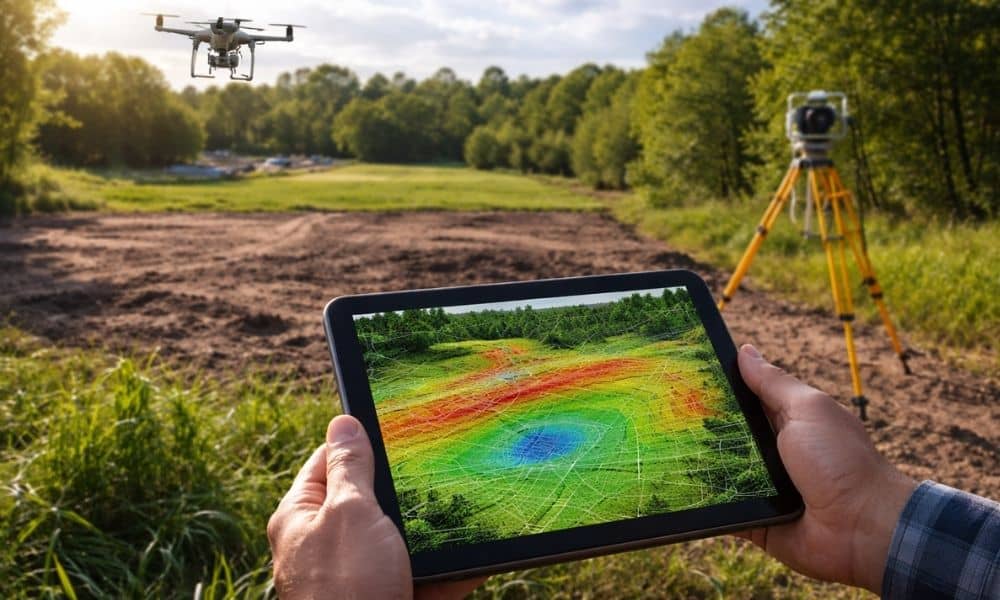
Buying a lot in St. Louis might seem straightforward at first. You drive by, see a nice open piece of land, and start imagining your future home or project. But often, what looks ready on the surface can hide surprises. Small slopes, low spots, or past grading work can create problems you won’t notice until it’s too late, adding cost and delays. One way to get a clearer picture is using lidar mapping to check elevation before building. It helps you see how the land really sits, so you can plan ahead instead of guessing. That way, you understand the lot better before spending money on surveys or construction prep.
Why Some St. Louis Lots Can Be Misleading
At street level, most lots look flat. Grass covers the surface, and everything appears even. Still, that view can hide what is really happening underneath. In many parts of St. Louis, land has been shaped over time. Older neighborhoods often include areas that were filled, leveled, or adjusted during past construction.
Because of that, two lots that look the same can behave very differently. One may drain well, while the other may collect water after every rain. In addition, a lot that seems level may actually slope just enough to affect where you can build.
So while a quick visit helps, it does not tell the full story. That is why taking a closer look before moving forward makes a big difference.
What LiDAR Mapping Helps You Understand Early
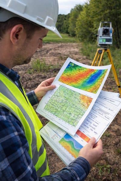
LiDAR mapping lets you see the land in a way your eyes can’t. What looks flat from the street can actually have gentle slopes or dips that affect drainage or where you can build.
Using lidar mapping to understand how your lot slopes helps you get a real sense of the property and how it compares to the surrounding land. For example, if the neighboring lots are higher, water might naturally run toward your lot.
Knowing this ahead of time can save you headaches later. It gives you a clear picture of what the site might need before any surveys or construction begin.
Seeing the Lot Beyond What the Eye Catches
When you look at a property in person, your eyes focus on what is easy to see. Flat grass and open space often give a false sense of simplicity. However, lidar mapping shifts your view. It lets you step back and look at the land as a whole.
Instead of focusing only on the area where a structure might go, you begin to understand how the entire lot behaves. The edges, corners, and nearby ground all play a role. In many cases, issues start outside the main build area and move inward over time.
Because of this, a lot that looks perfect at first glance may need more work than expected. By using lidar mapping early, you catch those details before they turn into problems.
How Elevation Changes Can Affect Your Plans
Even small elevation changes matter more than most people think. A slight slope can change how water moves. It can also affect how much grading is needed before construction.
For example, if one side of the lot sits higher than the other, you may need to level the ground. That adds time and cost. On the other hand, if part of the lot sits lower than nearby land, water may collect there after rain.
In St. Louis, where weather patterns can shift quickly, this becomes even more important. A small dip in the ground may not seem like a big deal at first. Still, over time, it can lead to drainage issues or foundation concerns.
So understanding these changes early helps you plan better and avoid unexpected work.
Why the Surrounding Land Matters Just as Much
A lot does not exist on its own. It connects to everything around it. Nearby homes, streets, and open land all influence how water and soil behave.
With lidar mapping, you can see how your lot sits compared to others. If it is lower than surrounding properties, it may act like a catch point for water. If it is higher, you may need to control how water flows away.
This bigger picture often gets missed during a simple site visit. However, it plays a major role in long-term performance. By looking at the surrounding land early, you gain a clearer understanding of what to expect.
Recognizing Signs of Past Land Changes
Some lots have been altered over time. Builders may have added fill, removed soil, or reshaped the land to fit earlier projects. While this is common, it can affect how the ground behaves today.
Lidar mapping can help you notice these changes. You may see areas where the slope does not match the rest of the lot. You may also notice uneven patterns that suggest past work.
These signs do not always mean trouble. However, they do mean the land may need closer review. Knowing this early allows you to ask the right questions before moving forward.
Understanding the Limits of LiDAR Mapping
While lidar mapping is a powerful tool, it does not replace professional field work. It gives you a strong starting point, but it does not provide everything you need.
For example, it will not show exact property lines or legal boundaries. It also will not confirm underground conditions or provide official measurements for permits.
That is why it works best as a first step. You use it to screen the lot, spot potential concerns, and decide if the property makes sense. Then, if everything looks good, you move forward with a licensed surveyor for detailed work.
Making Smarter Decisions Before You Spend
Pre-screening a lot with lidar mapping helps you slow down and think clearly. Instead of jumping straight into field work, you take a moment to understand the land.
This approach often leads to better decisions. You may move forward with more confidence. Or, you may adjust your plans based on what you see. In some cases, you may even decide to walk away before spending more money.
All of these outcomes are better than discovering issues later.
A Better Way to Start Any Land Project
Every project begins with a decision. Choosing the right lot is one of the most important steps. While no tool can remove all risk, lidar mapping gives you an advantage early in the process.
By using it to pre-screen a St. Louis lot, you gain insight that most buyers miss. You begin to understand how the land sits, how it connects to its surroundings, and what challenges may come next.
From there, you can move forward with field work in a smarter, more informed way.