
How to Find Someone to Survey Your Property Boundary Correctly

There are different reasons why somebody would need boundary surveying in their property. Often, this type of surveying is done if the owner of the property wants to legally place an item on the property such as a new structure or a fence.

A Licensed Land Surveyor

When hiring a land surveyor, you have to make sure that he is duly licensed by your state. A “licensed” land surveyor means he was able to complete his studies, passed all exams and is certified to perform specific types of land surveys.

Hiring a licensed land surveyor is especially important if there is a dispute over a certain area of a property as the court would be asking for the current boundary survey result as well as testimony from a licensed land surveyor. With this being said, you also have to make sure that the surveyor you’re going to hire can also stand as an expert witness in court.

Looking for a Licensed Land Surveyor
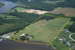
If your property has been surveyed before, it would be easier for you to contact that land surveyor again. This is the best option for several reasons; he already has all information about your property, making it easier for him to perform a new type of survey.

You can typically find your land surveyor’s information on the survey result given to you (if you’ve bought the property from somebody, for instance) or the result given to you by the surveyor himself.

If you don’t have the survey drawing, you can also check the markers put in place by the surveyor during the last survey done on your property. These markers, which looks like iron pegs or pipes, should have the surveyor’s license number/ name on it. You can use this information to find the surveyor online.

If you can’t find the surveyor who worked on your property before, or if the property has never been surveyed, you should easily find a land surveyor in your area (for a land surveyor in the Missouri area, click here).

Important Points to Remember when Hiring an ALTA Surveyor

  • As mentioned, make sure that he or she is a licensed land surveyor.
  • He or she should have experience in performing alta boundary surveys. If you’re going to pay somebody, you’d rather have someone who has done it before, right?
  • Look for someone easy to talk to. Communication is very important when hiring a land surveyor. You see, surveying is more of an art than a science – this is why land surveying results vary. It’s important that your surveyor understand why you’re having the survey, what you’re going to use the results for and how soon you’ll be needing the results.
author avatar
Surveyor

More Posts

A land surveyor uses GPS equipment to survey a property near an airport runway and highway construction project
land surveying
Surveyor

Land Surveying Before Buying Near Airport or Highway Projects

Kansas City is growing in a specific direction right now. Transportation dollars are flowing into the metro. There’s talk of a rail line connecting KCI to downtown. The I-35 and Highway 71 corridors are under review for major overhauls. Airport zoning near the downtown airfield has already shifted to allow

Read More »
Professional boundary survey of an irregular lake lot showing shoreline measurements, property boundaries, and dock access near the water
boundary surveying
Surveyor

Boundary Survey Price Questions for Irregular Lake Lots

A lot listing at Lake of the Ozarks might read “0.34 acres, lake view.” That number tells you almost nothing about what a survey will cost. Table Rock Lake and the Lake of the Ozarks are pulling in a steady wave of buyers right now, and most of them price

Read More »
An aerial view of a wooded property beside its LiDAR terrain model, illustrating how LiDAR mapping before floodplain development reveals the land's true elevation, contours, and natural drainage patterns
land surveying
Surveyor

LiDAR Mapping Before Floodplain Development

Building near a floodplain takes more than a quick look at a flood map. Water doesn’t follow neat lines drawn by FEMA. It follows the actual shape of the land, dips, slopes, and low spots that most maps never show. That’s where LiDAR mapping comes in. It gives developers a

Read More »
Licensed land surveyor reviewing two adjacent residential lots before preparing a lot consolidation survey for an infill development project
land surveyor
Surveyor

Licensed Land Surveyor Reviews Before Combining Adjacent Lots

Infill housing is changing how buyers think about land. Instead of hunting for one big empty lot, more developers are buying two small ones next door to each other and merging them into a single buildable parcel. It sounds simple. Draw a line, erase it, done. But a licensed land

Read More »
Licensed land surveyor reviewing a plat of survey before planning a detached garage on a residential property
land surveying
Surveyor

Plat of Survey Checks Before Adding a Detached Garage

A detached garage looks simple on paper. Four walls, a roof, maybe room for a truck and some tools. But before you break ground, your plat of survey tells you what’s actually possible on the lot. For developers working on infill projects or backyard builds, skipping this step can cost

Read More »
Licensed land surveyor locating a missing residential property corner marker with GPS equipment before installing a new fence
boundary surveying
Surveyor

Surveyor for Fence Work When Old Corner Markers Are Missing

You want to put up a fence. Simple enough, until you realize nobody can find the actual corner of the lot. The old marker that should be there is gone, and the fence line everyone’s used for twenty years might not be the real property line at all. This happens

Read More »